Bowl of Fire (Southwest)
Lk. Mead Natl. Rec. Area
Overview:
The Bowl of Fire is located in the Muddy Mountains Wilderness Area, within the boundaries of Lk. Mead Natl. Rec. Area.
This beautiful and diverse area is similar to the Valley of Fire (approx. 20 miles Northeast) and is characterized with brilliant-red Jurassic-Age sandstone outcrops surrounded by gray limestone mountains.
The limestone is the sides of the bowl, and the red sandstone is the fire in the bottom.
Formed from ancient sand dunes the now petrified red sandstone is heavily eroded into fantastic shapes with "large" red sandstone crags, pinnacles, bowl-shaped cavities and small arches: all of which being bisected by dry washes and desert vegetation.
Be prepared for lots of sand and loose rock as the route should be considered "moderately difficult" for seasoned hikers.
The area is undeveloped with little visitation, chances are you will not see any fellow hikers (especially mid-week).
In summary, the Bowl of Fire is a place of solitude and silence with spectacular scenery: a great place to wander thru a wonderland of red sandstone formations.
Note:
The Bowl of Fire is typically divided into two areas, the Bowl of Fire (North) and the Bowl of Fire (Southwest): both of which can be accessed via the Hiking Route Directions (listed below).
The route documented within this web-page is entirely within the Bowl of Fire (Southwest).
The route is not clearly marked (GPS is recommended): being a combination of cross-country travel (with use-trails) and washes (thru "jumbles of rock") which can make it easy to lose one's sense of direction.
This adventure "requires" route finding and terrain awareness, inexperienced persons should consider traveling with an experienced person or group.
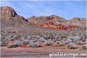
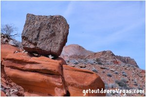
...Bowl of Fire scenery
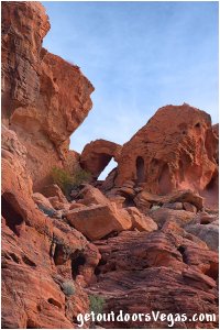
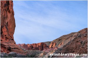
...Bowl of Fire scenery
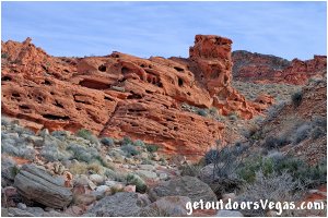
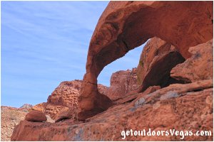
...Bowl of Fire scenery
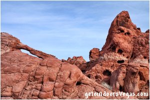
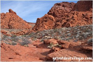
Information / Tips:
This adventure would make a great stopover while enjoying the Lake Mead National Recreation Area.
Bring plenty of water / snacks, hat, sunscreen, sunglasses and hiking boots (advised).
Keep an eye out for wildlife (wild horse and burro, Bighorn Sheep, lizards, birds and of course snakes).
DON'T forget your camera.
• Trailhead Parking amenities: None
(vault toilet: 2.5 miles+- North at
the Northshore Summit Trailhead)
• Bowl of Fire (SW) Hike: not ADA accessible
• Dogs are permitted (on leash)
• Limited Shade
• No Water Available
• Use Caution Around Northshore Road
(watch yourself and your kids)
..........
Rec. Area Hours 24hrs/day, 365days/year
2023 Entry Fee (valid 7 days): $25 vehicle & occ.
Free Entry Days (dates vary by year):
* M. L. King Jr. Day - mid January
* 1st day of Natl. Park Week - mid April
* Great Amer. Outdoors Act - EARLY AUGUST
* Natl. Park Service Birthday - LATE AUGUST
* Natl. Public Lands Day - LATE SEPTEMBER
* Veterans Day - mid November
..........
nearby: Cottonwood Wash
nearby: Lower Lovell Wash
nearby: Northshore Summit
nearby: Redstone
Warning:
This adventure involves travel to a relatively remote area, please refer to the section on desert travel for safety information.
Make sure you have a full tank of gas and a fully pressurized spare tire.
• This route is within an isolated area, don't
expect to see any other hikers, especially
if hiking mid-week
• Be mindful of lightning / flash floods
• Watch for snakes
• NO CELL PHONE COVERAGE
• AVOID THE AREA DURING EXTREME HEAT
• You are responsible for your own safety
Hiking Route Directions:
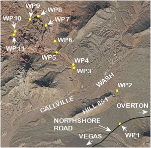
From the parking / trailhead area (WP1) located at Mile 18.2 on Northshore Road, head across the open desert (in a Northerly direction) towards the Northeasterly Toe of Hill 651 (see map below).
Note: this section of the route utilizes a use-trail (becomes evident approx. 200 feet+- North of WP1) which eventually runs up-slope and around the Northeasterly Toe of Hill 651 to WP2, being 0.35 miles+- distant of WP1.
From WP2 (use-trail quickly fades away) the route continues cross-country in a Northwesterly direction heading towards the red sandstone cliffs of the "Bowl of Fire" seen in the distance.
Along this section the route crosses Calville Wash and continues in a Northwesterly direction to the Easterly edge of a well defined "North-South" running wash (aka. Bowl of Fire Wash) and WP3, being 0.46 miles+- distant (as the bird flies) of WP2.
Note: once across Calville Wash hikers can look for a faint use-trail, just left of and running "somewhat parallel to" the aforementioned Northwesterly bearing (between WP2-WP3), that runs directly to WP3.
From WP3 the route drops into the wash and runs "upstream" to a point where the wash forks and WP4, being 0.04 miles+- distant of WP3.
From WP4 the route bears "Left" continuing upstream along the wash (which eventually narrows) for 0.21 miles+- to WP5.
Note: at WP5 hikers are confronted by a jumble of dark gray colored boulders which create a small pour-over (scale towards the right).
Once Atop the pour-over (hikers have entered the "Bowl of Fire") continue upstream (thru a short section of dark colored boulders) following the "main" wash which arcs hard to the Right, eventually traveling to a point where the wash forks and WP6, being 0.13 miles+- distant of WP5.
From WP6 the route bears hard "Left" and continues upstream, eventually passing thru a relatively "short / narrow" red sandstone canyon to where the wash forks and WP7, being 0.21 miles+- distant of WP6.
From WP7 the route bears "Left" continuing upstream to where the wash arcs hard to the Left (Westerly) and WP8, being 0.12 miles+- distant of WP7.
From WP8 continue upstream to a point where the wash forks and WP9, being 0.10 miles+- distant of WP8.
Note: at WP9 the wash forks into three segments.
From WP9 the route takes the "Left Most" of the aforementioned three segments, continuing upstream to a point where the wash forks and WP10, being 0.22 miles+- distant of WP9.
From WP10 the route bears "Left" continuing upstream for 0.03 miles+- to a 5 foot high pour-over and WP11, being the end of this route description.
Return by reversing route.
..........
Note: it is recommended to utilize internet mapping resources such as aerial photography (not always current) and the provided waypoint positions to visualize your route prior to visiting this area.
Following the route as described above, hikers with a map (include aerial photography) can keep track of their position (more or less), confused hikers can just hike downhill (following washes) to exit the Bowl of Fire.
Keep track of your surroundings (look back often) when hiking in this area, utilizing landmarks will help on your return route.
This adventure requires route finding and terrain awareness, inexperienced persons should consider traveling with an experienced person or group.
The use of a handheld GPS unit is recommended, know your GPS device's settings and use.
Remember: you are responsible for your own safety.
..........
Route Summary (as described):
Distance: 3.74 miles+ (out & back)
* actual distance will vary due to
"significant" cross-country travel
between WP2 & WP3
..........
WP1: N36.21093 W114.65641
parking / trailhead
WP2: N36.21565 W114.65769
northeasterly toe Hill 651
WP3: N36.21916 W114.66466
trail drops into Bowl of Fire Wash
WP4: N36.21973 W114.66470
wash forks
WP5: N36.22142 W114.66754
pour-over_enter bowl of fire
WP6: N36.22311 W114.66790
wash forks
WP7: N36.22545 W114.66963
wash forks
WP8: N36.22682 W114.67082
wash turns westerly
WP9: N36.22640 W114.67250
wash forks
WP10: N36.22462 W114.67514
wash forks
WP11: N36.22418 W114.67540
pour-over / end of described route
Note:
See desert travel for GPS Waypoint info
All distances and waypoints are approximate
Driving Directions:
From the intersection of NV-564 (E. Lk. Mead Pkwy.) and NV-167 (Northshore Rd.) within Lk. Mead National Recreation Area head North on Northshore Rd. for 18.2 miles+- (0.2 miles past Mile Marker 18) to a paved pullout (WP1) on the Left (North) side of the road.
Note 1: the trailhead parking area has no signage, therefore keep an eye on the "Mile Markers" as you progress Northbound on Northshore Rd.
Note 2: be aware of oncoming traffic, as the view is somewhat compromised by a curve in the road.
Return by reversing route.
Approx. 42 miles from central Vegas Strip via I-15 South, I-215 East, NV-564 East (E. Lk. Mead Pkwy.) and NV-167 (Northshore Rd.) to the Bowl of Fire (SW) Parking Area.
