Ash Meadows Natl. Wildlife Refuge
Section Index:
Overview:
In a remote corner of southern Nevada, the 23,000 acre Ash Meadows National Wildlife Refuge (est. 1984 - managed by the Fish and Wildlife Service) is located in one of the hottest and driest regions of North America.
Being a unique ecosystem in the dry Mojave Desert, Ash Meadows benefits from a "vast underground aquifer" extending 100 miles Northeasterly of the wildlife refuge.
This "ancient ground water" (often referred to as fossil water) flows Southwesterly to the Ash Meadows area where it is forced to the surface (by geologic faults) resulting in over 50 seeps and springs with a combined flow of over 10,000 gallons per minute year round: most of which flows into seven major springs.
These resultant seeps and springs sustain many wetlands (scattered throughout the refuge) which provide critical habitat for at least 26 endemic plant and animal species which occur nowhere else on earth.
Of these 26 endemic species, the most surprising (for many people) are the refuges four native "endangered" fish species.
They include the Ash Meadows Speckled Dace, the Ash Meadows Amargosa Pupfish, the Warm Springs Pupfish and the Devils Hole Pupfish.
The Ash Meadows Speckled Dace prefer areas with "swift" flowing water and might be seen in Bradford Springs (see Historic Cabin below) and outflow streams.
The Ash Meadows Amargosa Pupfish can be seen in the spring and associated outflow stream at both Kings Pool (best viewing opportunity) and Crystal Spring.
The Warm Springs Pupfish are rarely seen by refuge visitors, being associated with springs "not advertised on refuge maps" and rarely visited.
The Devils Hole Pupfish, by far the most famous of Ash Meadows native fish species reside in a water-filled "vertical" cavern (view is from "far" above) cut into a rocky hillside within a highly secured (but very interesting) area administered by Death Valley Natl. Park.
Within Ash Meadows many other wildlife species can be seen on the refuge, some endemic and others quite rare outside the refuge boundaries.
Wildlife includes mammals (many of which are nocturnal) with rodents, rabbits, squirrels (often seen) and the occasional Bighorn Sheep to name a very few.
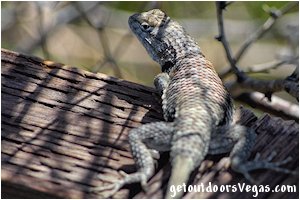
Common reptiles, including lizards (often seen) and snakes are around, along with ever present and or migratory (seasonal) birds.
All of which call Ash Meadows home or visit during the year.
Plant species (some of which are endemic) are surprisingly abundant within Ash Meadows thanks to an "ample" water supply and the vegetation's ability to tolerate the harsh Mojave Desert climate.
Its interesting to note that in years of abundant rainfall (avg. 3in/yr) the refuge may have on display (in bloom) over 330 species of flowers and shrubs.
Other common plants include Mesquite, Ash, Cottonwood, Creosote Bush, Desert Mistletoe, occasional cacti, and native grasses (along springs and streams) to name a few.
Overall Ash Meadows is a fascinating area, home to endemic plant & animal species (occurring nowhere else on earth), rare desert wetlands with associated vegetation and crystal blue springs & flowing streams along with awesome views of the surrounding mountain terrain: all of which made possible due to unique geological processes which "carry" water to this thirsty yet beautiful desert landscape.
Note: Presented on this webpage are four "major" areas (with one additional area of interest - historic cabin) which in the author's opinion are "must see" while visiting Ash Meadows National Wildlife Refuge.
These sites are presented in order to minimize driving distances (day-trip from Vegas); however, each site can be visited in any order or from any refuge entrance point.
Point of Rocks / Kings Pool:
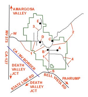
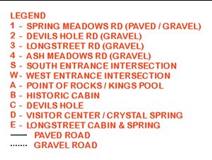
From the South Entrance Intersection (located at Bell Vista Rd & Spring Meadows Rd) bear Right (Northerly) onto Spring Meadows Rd (gravel) and travel for 0.8 miles+- to a gravel turnout (entrance sign / information kiosk - no other amenities).
From the entrance sign continue Northerly along Spring Meadows Rd for an additional distance of 3.1 miles+- to the intersection of Spring Meadows Rd & Point of Rocks Rd (signs mark the turnoff).
Turn Right (Easterly) onto Point of Rocks Rd (gravel) traveling 1.5 miles+- to the parking area for Point of Rocks.
..........
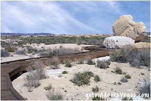
The Point of Rocks area comprises of several small springs, vegetation thickets and one spring pool (Kings Pool) with it's outflow stream: all linked together by a nice "boardwalk trail" (0.5 miles+- out & back).
Along the boardwalk trail the route is very apparent even though there are a few intersections: it is suggested to "bear Right" every time one is encountered.
Note: the boardwalk for the "most part" is ADA accessible (use your own judgment), however "shortly beyond" the Kings Pool viewing area (approx. 500 feet) the boardwalk steepens (and eventually ends) as it climbs upward towards a very nice "somewhat shaded" viewing area atop a small hill.
At "boardwalks end" a dirt path (Right) leads to the viewing area, to the Left said dirt path eventually runs steeply downslope (not ADA accessible) returning to the boardwalk in the Kings Pool area.
Once back at Kings Pool return via said boardwalk towards the Point of Rocks parking area.
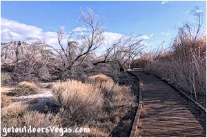
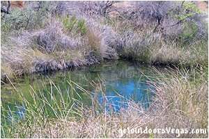
...trailside scenery
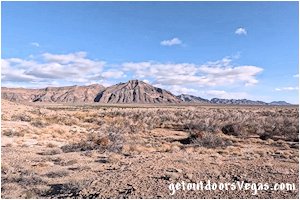
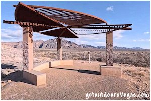
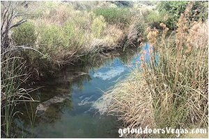
Although there is a lot to see along the Point of Rocks boardwalk trail, the main feature (for most people) is Kings Pool and it's outflow stream.
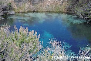
Kings Pool, like other spring pools (Crystal & Longstreet) documented on this webpage, is characterized by "intense blue hued" water (under favorable weather conditions) due to dissolved limestone which reflects blue light (especially noticed in deeper water).
In fact, water color changes from "crystal clear" in shallower areas to "crystal clear - blue hued" at greater depth, which explains why the "shallower outflow stream(s)" typically appear crystal clear (fossil water is very pure).
Kings Pool is approx. 25 feet x 20 feet with a depth of 8 feet at its deepest point, with water flow being 1,200 gallons per minute year round and a water temperature of 90°F (year round).
Being "home" to the endemic Ash Meadows Amargosa Pupfish, Kings Pool and it's outflow stream (between the Parking Area and Kings Pool) are places to spot this amazing little fish.
Other Interests along the Point of Rocks boardwalk trail are information signs (English and Spanish), close examination of native plants, a chance to see wildlife (a birders paradise), reference to historic peoples, other spring fed streams (no fish), as well as great views of the surrounding area and nearby mountains.
..........
Amenities include: ample parking (ADA & over-sized vehicle), restroom facility, trash bins, kiosk, shaded picnic area and a "boardwalk trail" with informational signage & strategically places benches.
Note: limited to no shade along the Point of Rocks boardwalk trail, no drinking water available at Point of Rocks.
Historic Cabin:
From the Point of Rocks Area return to the intersection of Spring Meadows Rd & Point of Rocks Rd and turn Right (Northerly) onto Spring Meadows Rd traveling 150 feet+- to a gravel "access road" (on your Left - no signs).
Turn Left (Westerly) onto this "access road" which immediately ends in a cul-de-sac like parking area for the Historic Cabin.
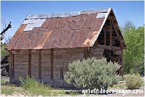
The Historic Cabin, sometimes referred to as the "Bradford Cabin" is located within the cul-de-sac like parking area.
The cabin is constructed from railroad ties which may have been utilized from the Tonopah & Tidewater (T&T) railroad (abandoned 1933) or a "secondary rail line" that was linked to the T&T.
After railroads were abandoned it was common practice (historically) to remove the steel rails while leaving the railroad ties in place, becoming a "valuable source" of building material for nearby residents or homesteaders.
Today, old scars from the railroad spikes (even some spikes themselves) still mark the walls of this historic cabin.
A sign within the immediate vicinity of the cabin "designates" this historic cabin and surrounding area as an "Archaeological Site" which will "hopefully" protect it and it's historical significance for many years to come.
Unfortunately, not much is known about this cabin.
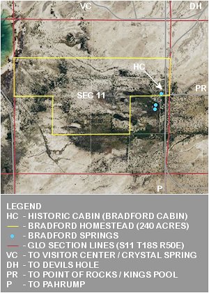
Ash Meadows staff refer to a "Bradford Homestead" (160 acres) patented (Dec. 1916) with a second patent (80 acres) "awarded" Nov. 1926 (combined total: 240 acres).
After exhaustive research, patents describing the Bradford Homestead location were found (BLM).
Utilizing aerial photography which includes GLO section lines (USGS), the map (immediately above) is based upon these combined documents with "comments" provided by your author.
Interestingly, it is "common knowledge" that this historic cabin has "moved" (possible more than once) from it's original location (unknown) to it's current location: it's current location being visible on Google Earth™ historic imagery (1994) for at least 30 yrs.
It is not known if the Bradford Homestead and or historic cabin was "responsible" for the naming of nearby Bradford Springs, which is only referred to as "springs" on "very old" (1952) USGS mapping (though it does make sense).
Of Note: Bradford Springs, located Southerly of the historic cabin, and associated outflow streams are noted (see Overview above) for being one of only two "present-day" habitats (both within Ash Meadows) of the endemic Ash Meadows Speckled Dace.
..........
Amenities: None
..........
• BLM - Bureau of Land Management
• GLO - General Land Office
• USGS - United States Geological Service
• getoutdoorsVegas.com is not
affiliated with Google Earth™
Devils Hole:
From the Historic Cabin parking area return to Spring Meadows Rd and turn Left (Northerly) traveling 0.47 miles+- to a "T-intersection" (Spring Meadows Rd & Devils Hole Rd), being a total distance of 0.5 miles+- distant of Point of Rocks Rd.
Note: from this "T-intersection" Spring Meadows Rd continues Left (Westerly) while Devils Hole Rd bears Right (Easterly).
Turn Right (Easterly) onto Devils Hole Rd (gravel) traveling 1.4 miles+- in a Easterly then Northeasterly direction to a "gated" gravel service road (on your left - signs mark the area) and parking for "foot traffic" access to Devils Hole (do not block the gate).
..........
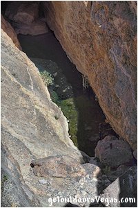
Devils Hole, a 40 acre detached unit of "nearby" Death Valley Natl. Park, is a water-filled cavern exposed at the base of a rocky hillside within the Ash Meadows Natl. Wildlife Refuge complex.
Water at the cavern's near vertical opening covers a surface area of approximately 11 feet (in width) and 50 feet (in length), descending (at least 500 feet+-) to an unknown final depth.
The calm, carbonate-rich & oxygen-poor water of Devils Hole is a constant 93°F in the deeper reaches of the cave and is often warmer in the shallows.
Devils Hole is the only habitat (anywhere) for the "naturally occurring" population of the endemic Devils Hole Pupfish.
The pupfish have been seen as deep as 80 feet+- but "spend their lives" feeding (algae / small invertebrates / micro-organisms) and spawning on a small "often sunlit" rock shelf (11 feet+- x 16 feet+-) located just below the waters surface; making this "rock shelf" the smallest known range of any vertebrate species on the planet.
Of Interest: Devils Hole Pupfish "average" just shy of an 1 inch in length (mature adults) and have a lifespan of up to 14 months.
...trailside scenery
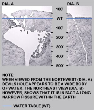
Within Devils Hole, water level is "very critical" for the Devils Hole Pupfish, being the rarest fish in the world and on the endangered species list (1967).
In addition to "inbreeding" concerns (due to small habitat) and a "historically" small population size; water levels in Devils Hole were decreasing (late 1960s to early 1970s) due to an increase in farming and development within the area (groundwater pumping).
Eventually, the water level in Devils Hole was protected by a U.S. Supreme Court decision (1976) which limited groundwater pumping to a level which "helps to ensure" the ongoing survival of this unique little fish.
A Devils Hole Pupfish "population count" is conducted every spring and fall, using standard (statistical) protocols.
Scientists, utilizing scuba gear, descend as deep as 100 feet where they observe (count) fish within the cavern.
Simultaneously, other scientists count fish on the "feeding and spawning" rock shelf located near the waters surface.
The resultant counts are then combined to determine the average population for any given time period.
Pupfish Population Census (spring count)
• prior to mid 1990s: 200-250 individuals
• over next 20 years: average 90 individuals
• recent years: higher counts
• all time low (2013): 35 individuals
• April 2024: 191 individuals (most since 1991)
Due to its sensitive nature Devils Hole (itself) is off limits to the public, being surrounded by heavy fencing, cameras and motion detectors.
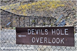
However, the public can access a viewing platform (within a "tunnel" of cyclone fencing) which overlooks Devils Hole from above (approx. 40 feet).
From the viewing platform the pupfish themselves are impossible to see with the "naked" eye; therefore, utilizing high powered binoculars "may enable" visitors to see the tiny fish.
..........
From the Devils Hole parking area, walk 640 feet+- (0.12 miles) in a Northwesterly direction along the "gravel service road" towards the security fencing (easily seen from parking area).
Once at the fencing bear Left, following the "fence face" for 50 feet+- (0.01 miles) to an opening which provides access to the "cyclone fence tunnel".
Walk thru the cyclone fence tunnel for 90 feet+- (0.02 miles) to the viewing platform.
Return by reversing route.
Approx. distance: 0.3 miles+- (out & back).
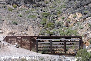
Note: as your walking towards Devils Hole (from the parking area) look for a rough footpath and "box like" medal structure to the Right (Northeast) and above the secured area around Devils Hole.
Following this "rough trail" visitors can hike up to the medal structure which prevents access into Devils Hole II Cave (not to be confused with Devils Hole).
Devils Hole II Cave, first explored underwater in 1961 has a vertical entrance which is visible thru openings in the medal structure and water (cannot be seen) at a depth of approx. 120 feet below ground level.
It has been theorized that Devils Hole II Cave and Devils Hole connect at some point underground, though this fact remains undiscovered.
The hike up to Devils Hole II Cave (and back) will add approx. 20min to your Devils Hole visit (not ADA accessible).
..........
Amenities: information signage, viewing platform.
Note: mostly level walk to viewing platform (not ADA accessible), no shade, no restroom facilities or drinking water.
Visitor Center / Crystal Spring:
From the Devils Hole parking area return to the previously visited "T-intersection" (Spring Meadows Rd & Devils Hole Rd).
Continue straight ahead onto "Westbound" Spring Meadows Rd (gravel) traveling Westerly, Northwesterly, Northerly and eventually Westerly (do not turn off Spring Meadows Rd) for 2.1 miles+- and turn Left (Southerly) into the parking area for the Ash Meadows Visitor Center (sign marks the turnoff) & Crystal Spring Boardwalk, being 3.5 miles+- distant of Devils Hole.
..........
The Ash Meadows Natl. Wildlife Refuge Visitor Center is a "modern" visitor center which opened to the public on Jan. 2, 2015.
This 11,000 square foot visitor center replaced the former visitor center (double-wide trailer) in use since 1992.
The "new facility" was constructed with Bureau of Land Management "land sale money" via the Southern Nevada Land Management Act which was originated by Senator Harry Reid (Nevada).
The visitor center features shaded parking stalls, ADA parking, oversize parking, restroom facility, drinking water, interactive exhibits, displays, full scale model (map) of the Ash Meadows area, viewings of the Ash Meadows movie, bookstore, gift shop and a shaded picnic area.
Staff and volunteers are very helpful and well-informed on subjects such as the refuge’s history, conservation efforts, locations to explore and tips for spotting wildlife.
...trailside scenery
...trailside scenery
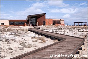
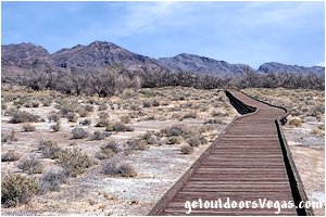
The Crystal Spring Boardwalk starts "behind" the Ash Meadows Visitor Center.
The boardwalk runs Southeasterly from the visitor center to a "Y" intersection with a semi-shaded "gazebo like" platform.
Although visitors can proceed in either direction, it is suggested to "bear" Left (Southeasterly) towards Crystal Spring proper and the Crystal Spring viewing platform.
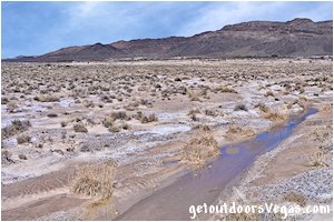
From the Crystal Spring viewing platform the boardwalk turns Westerly and "parallels" Crystal Spring's outflow stream to a point where visitors are forced to turn Right or Left (T-intersection).
Along this section of the boardwalk there are viewing platforms and "boardwalk side trails" that afford views directly above the outflow stream itself.
Continuing along the boardwalk trail, from the T-intersection turn Right (Northeasterly), travel back to the previously visited "gazebo" and onto the visitor center.
Although there is a lot to see along the Crystal Spring boardwalk, the main feature (for most people) is Crystal Spring and it's outflow stream.
Crystal Spring, like other spring pools (Kings & Longstreet) documented on this webpage, is characterized by "intense blue hued" water (under favorable weather conditions) due to dissolved limestone which reflects blue light (especially noticed in deeper water).
In fact, water color changes from "crystal clear" in shallower areas to "crystal clear - blue hued" at greater depth, which explains why the "shallower outflow streams" of Ash Meadows typically appear crystal clear (fossil water is very pure).
Crystal Spring is the largest spring (water volume) at Ash Meadows, its diameter being 30 feet+- with a depth of 15 feet at its deepest point, water flow being 2,800 gallons per minute year round and a water temperature of 87°F (year round).
Being "home" to the endemic Ash Meadows Amargosa Pupfish, Crystal Spring and it's outflow stream are places to spot this amazing little fish.
Other Interests along the Crystal Spring boardwalk trail are benches, information signs (English and Spanish), native and endemic plant species, a chance to see wildlife (especially birds), as well as great views of the surrounding area and mountains on the horizon.
The Crystal Spring boardwalk trail is approx. 0.9 miles (out & back), ADA accessible with little to no shade.
Longstreet Cabin & Spring:
From the Ash Meadows Visitor Center parking area return to Spring Meadows Rd.
Turn Left (Westerly) onto Spring Meadows Rd traveling 0.3 miles+- to the intersection of Spring Meadows Rd & Longstreet Rd (street sign identifies Longstreet Rd).
Bear Right (Northwesterly) onto Longstreet Rd (gravel) traveling in a Northerly direction for 3.4 miles+- to the Longstreet Cabin & Spring parking area (on your Left - signs mark the parking area).
..........
Jack Longstreet, one of the legendary gunslingers of the early West, arrived in Nevada in the 1880's seeking a fresh start from a shadowy past.
Having killed many men, his skill with a gun gave him a reputation as a dangerous man.
Because trouble seemed to follow him he found it necessary to live in remote places to avoid his enemies.
Longstreet epitomized the mythical Western frontiersman: self-reliant, strong-willed, and fair-minded.
Speaking with a southern drawl, he championed the rights of the Southern Paiute – with whom he often lived - and protected mine workers during disputes.
At the time of his death he was revered as a gruff but kind old man with many stories of his gunslinger days.
Jack Longstreet was a very colorful fellow:
↓↓ poem from Ash Meadows interpretative sign
"Notched his gun for each man killed / Local sheriffs were not thrilled / Five grooves placed upon that gun / Jack regretted only one / Built a cabin in Ash Meadows / To hide out from the posse fellows / Stones piled high to save his head / From pistols spitting white-hot lead / Jack spoke the indigenous Nuwuvi tongue / Some say just like a native son / A handy talent, one could claim, since / Most his neighbors spoke the same / From here he'd trek to mountain climes / Searching for lost treasure mines / Or stay at home and horses raise / Their long and leggy speed to praise / Mining, gambling, racing horses are / Tricky wealth producing sources / Then he sold this "Longstreet" spring / For the ransom of a king"
..........
From the Longstreet Cabin & Spring parking area a "boardwalk trail" heads Westerly towards the Longstreet Cabin & Spring.
Approx. 150 feet (from the parking area) the boardwalk circumvents a "display" of spring mound (definition: a dirt hill which forms over time as moist soils trap windblown dust) remnants.
Continue Westerly along the boardwalk for approx. 300 feet+- to boardwalk's end and the Longstreet Cabin area, being 450 feet+- distant of the parking area / boardwalk trailhead.
From the end of the boardwalk, explore the Cabin and nearby Spring.
Return by reversing route.
...trailside scenery
Longstreet Cabin:
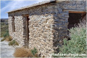
Looking for a protected and isolated place for a home, Jack Longstreet rode into Ash Meadows and found exactly what he was looking for: a clear spring, a "small cave" in a spring mound and open pasture for his horses.
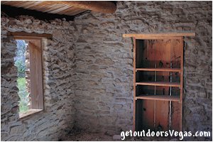
He enlarged the cave (which contained a semi-subterranean spring) and built a stone cabin into the side of the spring mound which formed the back wall of the cabin.
This strategy helped to cool the cabin in summer, provided space (in the small cave) for food storage and afforded "running water" within the cabin which was unheard of in the late 1800s in this part of Nevada.
Jack Longstreet and his wife lived in the cabin for about five years (from 1895-1899).
After relocating, Longstreet continued to visit the cabin until he finally sold the property in 1906.
In 1984, a flash flood reduced Jack Longstreet's cabin to rubble.
In 2004, a $90,000 grant from the Nevada Public Land Management Act was used to restore the Longstreet Cabin and Spring in Ash Meadows National Wildlife Refuge.
Historic restoration experts painstakingly set each stone back in its original position (based on historic photos).
Concrete block coated with a sandy-lime plaster replicates the spring mound that supported the cabin's back wall.
Restoration to the Longstreet Cabin and Spring concluded in 2006.
Today the restored cabin is open to the public, giving visitors a glimpse into the past.
Longstreet Spring:
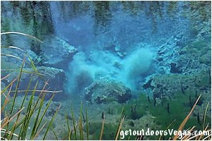
Situated directly in front of the Longstreet Cabin, Longstreet Spring emerges into a deep, very clear 30 foot+- diameter spring pool.
The spring pool is surrounded by mesquite and ash trees plus lots of shrubs, sedges and forbs.
Away from the edge of the spring, vegetation quickly changes to mesquite thickets with saltgrass and eventually dry desert saltbush.
An outflow stream flows Westerly (thru a ditch) into the desert landscape.
The spring discharges around 1,500 gallons of water per minute with a year-round temperature of around 82°F.
Longstreet Spring is sometimes called "the boiling spring" because fine white sand bellows up from the depths giving a boiling appearance.
There is a "boardwalk like" viewing platform which sits "above" Longstreet Spring, giving visitors a view into it's clear / deep waters and an opportunity to see the Ash Meadows Amargosa Pupfish.
..........
Amenities include: adequate parking (ADA parking), restroom facility (ADA accessible), trash bins, information kiosk and a boardwalk trail (ADA accessible) with information signage.
Bicycles not allowed on boardwalk trail.
Note: limited to no shade along the Longstreet Cabin and Springs boardwalk trail, no drinking water available at Longstreet Cabin / Springs.
..........
Return to Vegas: from the Longstreet Cabin & Spring parking area return to the previously visited Longstreet Rd & Spring Meadows Rd intersection.
At this point you have two options to return to the Vegas area (1) retrace your previous route by driving Spring Meadows Rd (Easterly then Southerly) to the South entrance intersection with Bell Vista Rd, then onto Pahrump and Vegas, total distance Longstreet Rd intersection (Eastbound) to Vegas approx. 87 miles.
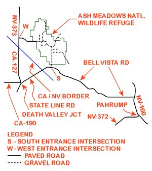
(2) turn Right (Westerly) onto Spring Meadows Rd traveling 2.2 miles+- to the Ash Meadows West Entrance Sign (at this point Spring Meadows Rd turns to asphalt).
Continue Westerly on Spring Meadows Rd for 3 miles+- to the West Entrance Intersection (NV-373 & Spring Meadows Rd).
Turn Left (Southerly) onto NV-373 traveling 1.9 miles+- to the Nevada / California border where the highway renames to CA-127.
Continue South on CA-127 traveling for 7.4 miles+- into Death Valley Jct and the intersection of CA-127 and State Line Rd.
Turn Left (Northeasterly) onto State Line Rd traveling 5.2 miles+- to the California / Nevada border where the highway renames to Bell Vista Rd.
Continue Northeasterly then Southeasterly on Bell Vista Rd for 2 miles+- to the previously visited South Entrance Intersection with Spring Meadows Rd.
Continue Southeasterly on Bell Vista road into Pahrump and onto Vegas, total distance Longstreet Rd intersection (Westbound) to Vegas approx. 102 miles.
Information / Tips:
Bring plenty of water / snacks, hat, sunscreen, sunglasses and comfortable shoes.
Make sure you have a full tank of gas and a fully pressurized spare tire.
• DON'T forget your camera
• Dogs allowed (on leash): "OK" on boardwalks
but never in water or within the Visitor Center
• Swimming prohibited: however allowed within
Crystal Reservoir (history of swimmer's itch)
• Drones are prohibited
• Limited to no shade (along boardwalks / trails)
• Boardwalks (ADA accessible)
• Bicycles are prohibited on boardwalks
• Shaded picnic tables (ADA accessible)
(Visitor Center & Point of Rocks)
• Restroom facilities (ADA accessible): located
at each site documented within this webpage
(exception: Devils Hole / Historic Cabin)
• Water: available at Visitor Center
• Ash Meadows Natl. Wildlife Refuge is open
daily (weather permitting) sunrise to sunset
• Entry fee: None
..........
Note:
The refuge's gravel roads are maintained for regular vehicles / motorcycles (must be street legal).
Road conditions can vary due to inclement weather (and general effects of usage).
Expect some or all roads within the refuge to be closed after major storm events due to hazardous conditions such as mud, standing water and or occasional washouts.
With this in mind it is recommended to call the Visitor Center prior to your visit for road conditions (and other unexpected issues) especially during and after inclement weather.
..........
Visitor Center:
• 8757 Spring Meadows Rd
Amargosa Valley, NV 89020
• open: 7 days a week, 9am-4pm
• 775-372-5435
it is suggested to contact the Visitor
Center as hours may vary by season
..........
nearby: Death Valley Natl. Park
(single day itinerary)
Warning:
These adventures involve travel to a relatively remote area, please refer to the section on desert travel for safety information.
• Be mindful of lightning / flash floods
• Watch for snakes
• AVOID THE AREA DURING EXTREME HEAT
• You are responsible for your own safety
Driving Directions:
From the I-15 (Las Vegas Fwy) interchange with W. Flamingo Rd proceed South on I-15 for 4.7 miles utilizing the right 2 lanes and merge onto Westbound NV-160 (Blue Diamond Rd - Exit #33).
Continue Westerly on NV-160 for just over 52 miles into the City of Pahrump and the intersection of NV-160 and NV-372.
NOTE: WHILE IN PAHRUMP BE SURE TO FILL OR TOP OFF YOUR TANK; there are no stations beyond Pahrump or within Ash Meadows Natl. Wildlife Refuge.
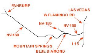
From the previously mentioned intersection of NV-160 and NV-372, continue in a Northerly direction on NV-160 for just over 4 miles turning left onto Bell Vista Rd.
Proceed Westerly on Bell Vista Rd for 22.7 miles+- to the "Ash Meadows South Entrance Intersection" (sign marks the turnoff) at Bell Vista Rd and Spring Meadows Rd (gravel).
Note: from the "South Entrance Intersection" driving directions are provided within the description for each area of interest (see above).
